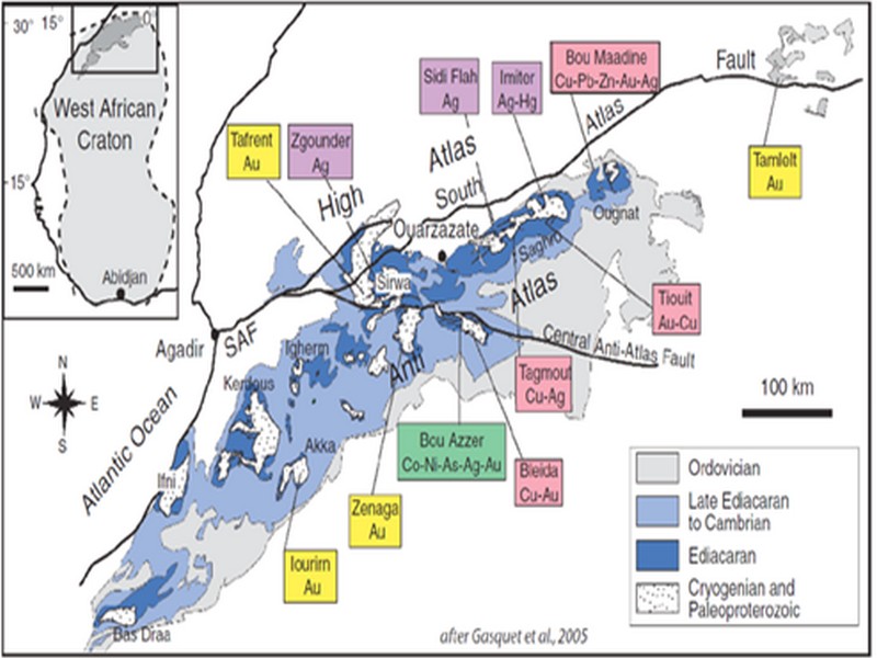

ORE DEPOSITS IN THE ANTI-ATLAS AND SUB-ATLAS REGIONS
The Anti-Atlas geological province is the host of a variety of ore deposits, ranging from Paléoprotérozoïque to Ordovician in age. These deposits are mainly Cu-Au porphyry types, precious metal epithermal (Au, Ag) or polymetallic VMS base metals (Cu, Pb, Zn, Au, and Ag), while the sub- Atlas region presents an important occurrence of manganese. Figure 8 shows the location of the most important deposits in the Anti-Atlas region.
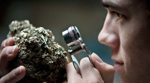
Located in eastern Anti-Atlas, the world class Imiter Ag-Hg mine (8.5 Mt at 700g/t Ag), is among the most important deposits in Morocco. It is considered to be of epithermal origin. The silver mineralisation happened during regional extension (+/- transpession?) tectonic regime event around 550 and is hosted in a series of volcanic felsic rocks Ma (Tuduri et al, 2006). Briefly, a three-stage model has been proposed to explain the deposit: a first episode characterized by the development of quartz, pink dolomite, and Ag-rich minerals veins formed during a dextral transpressive event, followed by a barren stage associated with a normal left-lateral motion that re-opened previous structures, and a final alteration stage (i.e. supergene enrichment) that contributed to local enrichment in Ag deposit (Tuduri et al, 2006).
Regarding copper, Bleida was the most important Cu deposit of northern Africa until late 90’s. Located on the northern edge of the West African Craton, the Bleida orebodies are located on an inactive continental margin along with preserved ophiolites of Upper Proterozoic age. The copper deposits (chalcopyrite, bornite, pyrite) are stratiform distal massive sulfide bodies whose position is controlled by both the sedimentation of shales and an acid volcanism, which follows a more important basic volcanism. Pan-African deformation (650-600 Ma) has determined the current geometry of the cupriferous lenses although it has not remobilized the sulfides out of their original carrier beds (Leblanc and Billaud, 2006). West of the main Moroccan Bleida copper deposit, gold mineralization has also been discovered (West Bleida, ca. 3 tonnes metal Au). It is hosted by metamorphosed and deformed mafic to intermediate volcanic rocks that are part of the Neoproterozoic tholeiitic volcano-sedimentary series forming the stratigraphically upper part of the Bou Azzer ophiolite sequence. Gold mineralization primarily occurs
as deformed gold-bearing quartz veins and disseminations in Cu-rich chert zones (chalcopyrite– malachite), Fe-rich lithofacies and breccia zones. Gold is accompanied by small amounts of copper sulphides (<1% modal chalcopyrite).
Another important occurrence (not displayed in the map, Fig. 8) is the Imini Manganese deposit, the most important Mn deposit of Morocco, located in the western margin of the Ouarzazate foreland basin (Sub-Atlas). The manganese ore is made of pyrolusite (MnO2), and is hosted in different horizons of dolomites from the lower Cretaceous, and another accessory layer. This layers thickness can reach up to 1 meter. The deposit scale is 25 km per 100-400 m width, and sits above slates and crystalline rocks. Dolomitic sandstone and/or conglomerate are present between each mineralized horizon. Isabel von Steinaecker; source: http://www.geo.tu-freiberg.de/oberseminar/os03_04/Isabel_Steinaecker.pdf).

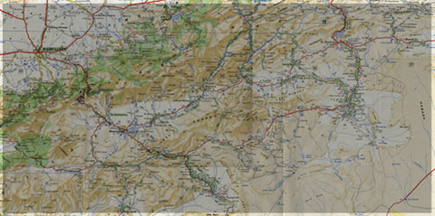
Figure 8: The Anti-Atlas belt at the northern limit of the West African Craton. Redrawn after Dallmeyer and Lecorché (1991) and a geological sketch map of the Anti-Atlas belt in southern Morocco and location of main ore deposits. SAF: South Atlas Fault. Gasquet and al. (2005)
Source web par unige.ch
Les articles en relation
Context geoghraphique , geologique et hydrogeologique
Context geoghraphique , geologique et hydrogeologique Professeur Bakkali Saad et Professeur Bouyalaoui Jaâfar Universidad de Guadalajara Guadalajara, México La zone étudiée appartient géographi
Savoir plus...
L'art rupestre « libyco-berbère » au Maroc: État des connaissances
1. Introduction Au début de l'été de 1874, le rabbin Mardochée es-Serrur, voyageur et homme d'affaires originaire d'Akka (Sud marocain), recevait à Paris un entrainement scientifique de
Savoir plus...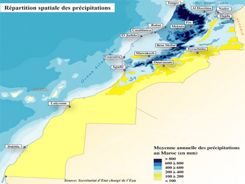
Retard des pluies: Faut-il craindre le pire?
Retard des pluies: Faut-il craindre le pire? Il est encore tôt pour prédire une année sèche Les mois de décembre et janvier seront de vrais baromètres Le régim
Savoir plus...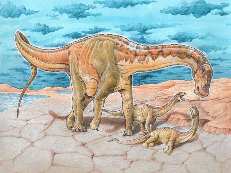
Une nouvelle espèce de dinosaure découverte en Argentine
Une nouvelle espèce de dinosaure découverte en Argentine Un dinosaure herbivore qui vivait il y a quelque 110 millions d'années vient d'être retrouvé en Argentine. Il s'agit d'une nou
Savoir plus...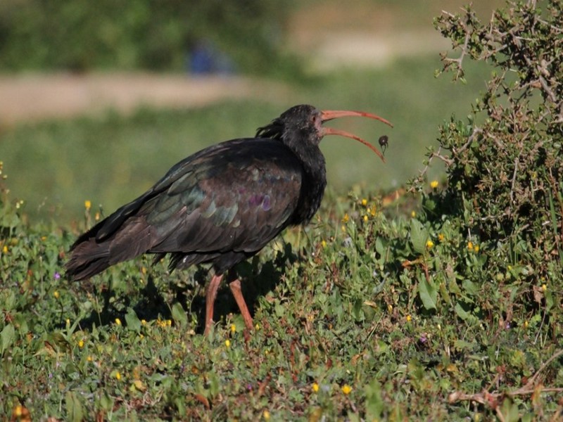
Larache: Observation d’ Ibis chauve
Larache: Observation d’ Ibis chauve Larache: Imad Yassine, un ornithologue amateur a rapporté hier matin une observation d’Ibis chauve dans la région. L’ornithologue a pu prendre quelques photos des oi
Savoir plus...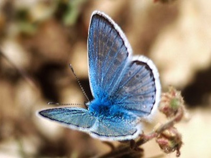
Le record de chromosomes détenu par un papillon maghrébin
Le record de chromosomes détenu par un papillon maghrébin Dans tout le règne animal, l’espèce qui comporte le plus grand nombre de chromosomes est un papillon du Maroc : l’azuré de l&rsq
Savoir plus...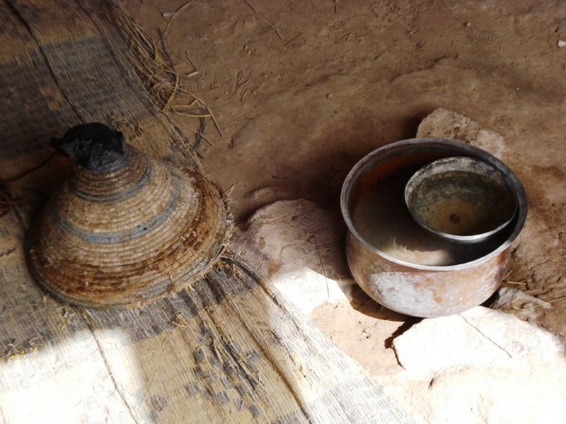
DAR TANASST et Horloge à eau
Nous quittons Tafraout en direction de Tata. Nous allons emprunter pour la première fois une nouvelle route qui mène plus directement à notre destination, nous évitant ainsi de remonter jusqu'à Igh
Savoir plus...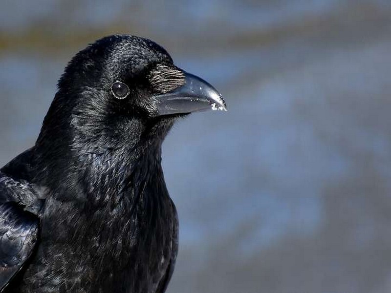
Des corbeaux ont appris à fabriquer des outils complexes tout seuls
Des corbeaux ont appris à fabriquer des outils complexes tout seuls Les chercheurs pensaient que cette aptitude était l'apanage des Hommes... et des grands singes. Mais une équipe internationale rév&eg
Savoir plus...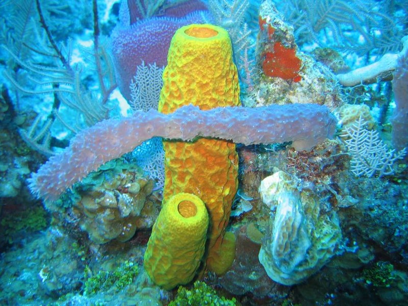
Les premiers animaux étaient peut-être des éponges
Les premiers animaux étaient peut-être des éponges Reconstituer l'origine des animaux, et en particulier sous formes multicellulaires, est l'une des clés permettant de déterminer notre origin
Savoir plus...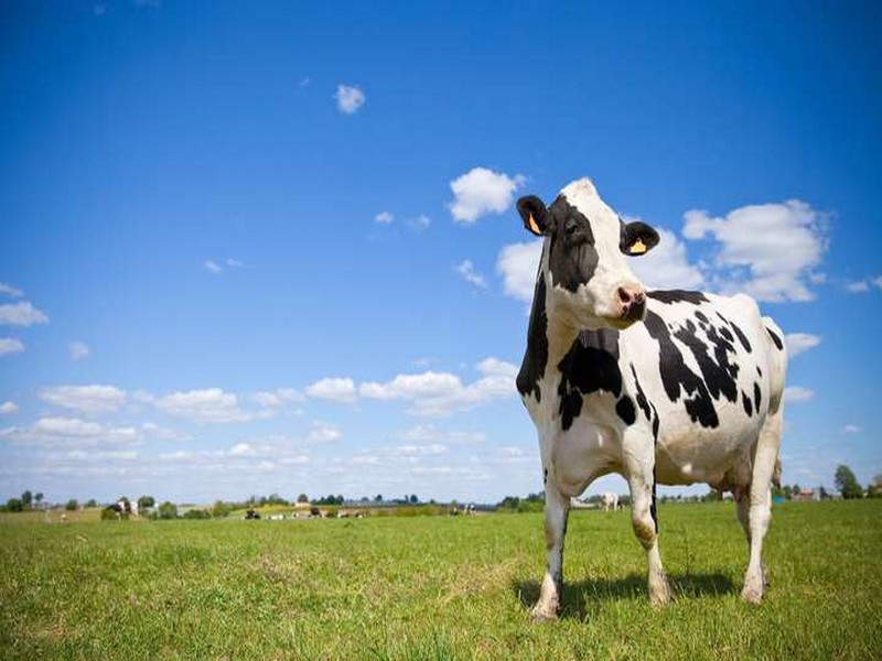
Vache
Vache La vache est un bovin de l'espèce Bos taurus. De manière générale, les bovins ont un mufle sans poil, humide autour des narines, des cornes lisses, creuses et persistantes, des molaires à
Savoir plus...
Phénomènes climatiques extrêmes : le réchauffement parfois seul en cause
Phénomènes climatiques extrêmes : le réchauffement parfois seul en cause Les scientifiques l'avaient annoncé : un jour, l'influence du changement climatique engendré par l'Homme de
Savoir plus...
le Maroc : un patrimoine diversifié, riche, avec des apports multiples pour Monsieur Omar ABBOU
le Maroc : un patrimoine diversifié, riche, avec des apports multiples pour Monsieur Omar ABBOU Monsieur Omar ABBOU Président de la Commune Urbaine de Figuig et Délégué Provincial de la Cu
Savoir plus...Les tags en relation
En savoir plus sur " Géologie et TSGJB - AMDGJB ! "
Consulter les vidéos de " Géologie et TSGJB - AMDGJB ! " Consulter les photos de " Géologie et TSGJB - AMDGJB ! " Consulter les publications de " Géologie et TSGJB - AMDGJB ! " Consulter les éditions de " Géologie et TSGJB - AMDGJB ! " Consulter les communications de " Géologie et TSGJB - AMDGJB ! "Recherche du site
Recherche avancée / SpécifiqueVulgarisation à la géologie
Qu'est ce que les sciences de la terre: vulgarisation Qu'est ce que la géologie ? Géologie et TSGJB - AMDGJB !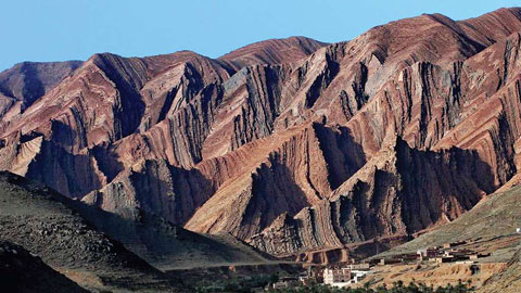
Géoparc et Recherche Scientifique
Le coins de l’étudiant
Blog Géoparc Jbel Bani
Dictionnaire scientifique
Plus de 123.000 mots scientifiques
Les publications
Géo parc Jbel Bani
Circuits & excursions touristiques
cartothéques
Photothéques
Publications & éditions