
STRUCTURAL EVOLUTION OF THE ANTI-ATLAS DOMAIN :AN OVERVIEW pour Yves Missenard
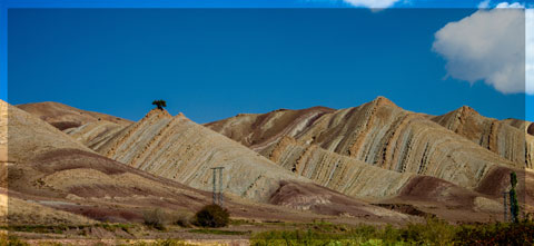
The Anti-Atlas represents the most important segments of the major Pan-African (≈0.5Ga) belt system of North Africa. This orogen exposed in a series of sporadic SW–NEtrending outcrops over 700km across southern Morocco, and reach ≈150km wide in the central part, west of Ouarzazate (Figure G1 & G2).Scattered outcrops of related rocks are described in NW Algeria which indicate that the belt continues from SE Morocco southeastwards with a NW–SEtrend.
The Anti-Atlas orogen comprises two main sequences of rocks: a metamorphic basement of Palaeoproterozoic (2Ga) age and the Neoproterozoic rocks. The Palaeoproterozoic rocks form the northern margin of the West African Craton mainly outcropping in the Reguibate Shield in Mauritania And Algeria. The Palaeoproterozoic basement is exposed in a series of uplifted inliers (‘‘boutonnieres’’) surrounded by the Neoproterozoic rocks that were locally deformed with the basement during the Pan African Orogeny. with the during the Pan African Orogeny.
Paleoproterozoic rocks and Eburnian orogeny
The oldest rocks of Morocco, Archean in age3 Ga(Montero et al, 2014) crop out in the southernmost Reguibat E shield which formsthe northern part the West African Craton (WAC).Further north, in the Anti-Atlas chain, the basement units are Paleoproterozoic (Taznakht Group, former” PI”)cropping only in the south of the Anti-Atlas Major Fault (AAMF). They are metamorphic rocks (greenschist to amphibolite facies) intruded by peraluminous and calc-alkaline granitoids dated around 2Ga(Thomas et al, 2002).The corresponding tectono-magmatic and metamorphic events are assigned to the Eburnian/Birimian orogeny.
Neoproterozoic rocks and Pan-African orogeny
As everywhere in the WAC, Mesoproterozoic rocks are lacking in the Anti-Atlas. Neoproterozoic Formations overlie directly the Paleoproterozoic basement. The Neoproterozoic/Paleoproterozoic boundary is generallya tectonic contact (thrust, strike-slip or detachment faults), and seldom a stratigraphic contact (Tizi n’Taghatine). Globally, the Neoproterozoic formations record three main stages of the Pan-African cycle (figureG4):
I .The early Neoproterozoic platform development is marked by the accumulation of thousands of meters of quartzites and stromatolitic limestones (Taghdoute Group, former “PII”), intruded by doleritic dykes and gabbroic intrusions. These rocks are associated with the rifting of the WAC margin, broadly contemporaneous with the oceanic accretion further north (760 Ma), witnessed along the AAMF by the Bou Azzer-El Graara and Siroua ophiolitic sequences (Bou Azzer Group).
II .Oceanic closure and subsequent Pan-African collision are associated with oceanic subduction along the northern margin of the WAC, ending with the accretion of oceanic arc formations (figureG4).The reported “blueschist facies” mineral associations in the Bou Azzer inlier are controversial. The polarity of the subduction remains also matter of debates; the same is true for the real location of the northern edge of the WAC. The oblique Pan-African collision(655 Ma to 640 Ma) generated south-verging thrust sheets onto the cratonic margin. South of the AAMF, the main Pan-African phase is recorded by low grade recrystallizations, synmetamorphic folds and various ductile and brittle structures in the Taghdout Group series.
III The Late to Post Pan-African extensional event is recorded by the extensive volcanic and volcano clastic series of the Ouarzazate Group (former “PIII”, 580 Ma to 560Ma), interbedded with subaerial to lacustrine deposits, which unconformably overlie the Eburnian and/or Pan-African basement units. The Ouarzazate Group shows abrupt variations of thickness and facies controlled by extensional tectonic activity. Various high-K calc-alkaline to alkaline plutons emplaced within the Ouarzazate Group, coeval with the volcanic rocks of comparable chemistry.

FigureG4: Generalized lithostratigraphic column for the Anti-Atlas Pan-African orogen. “PI” = “XI”, etc. are the classical stratigraphic symbols used on Anti-Atlas geological maps. HKCA: High-K calc-alkaline (granitoids) after Thomas et al. (2004), Gasquet et al. (2005) and Liégeois et al.2006 in Youbi et al., 2013

Source web par sociedadgeologica.es
Les articles en relation
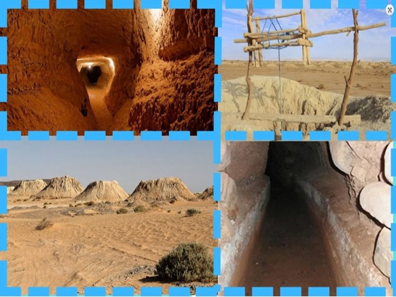
L'AMDGJB Geoparc Jbel Bani pour les bonnes causes : Rabat abrite le ler Sommet académique arabe sur l'eau, axé sur le rôle des jeunes et les khettaras
L'AMDGJB Geoparc Jbel Bani pour les bonnes causes : Rabat abrite le ler Sommet académique arabe sur l'eau, axé sur le rôle des jeunes et les khettaras Le 1er Sommet Academique Arabe sur l'Eau a Rabat :
Savoir plus...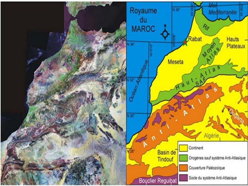
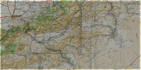
Situation géographique et bases géologiques pour Charles Robert-Charrue
Situation géographique et bases géologiques pour Charles Robert-Charrue Au Nord-ouest du continent africain, l’Anti-Atlas constitue le domaine austral du Royaume du Maroc. Comme le suggère l’image sat
Savoir plus...
L’Artisanat au Maroc
L’Artisanat au Maroc L’artisanat est classé au bon rang vis-à-vis des autres activités économiques au Maroc. Il représente l’énorme gisement économique du pays. Les p
Savoir plus...
San Francisco devient la première ville à interdire la vente de bouteilles en plastique
San Francisco devient la première ville à interdire la vente de bouteilles en plastique La pollution plastique est l’un des principaux fardeaux pour l’environnement. Croyez-le ou non, on jette suffisamment d
Savoir plus...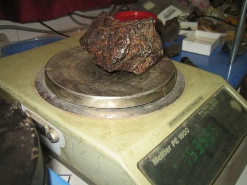
Laboratoire de géo-patrimoine et géo-matériaux de l’Université Ibn Zohr : Les premiers secrets de la météorite martienne «Tissint» révélés
Laboratoire de géo-patrimoine et géo-matériaux de l’Université Ibn Zohr : Les premiers secrets de la météorite martienne «Tissint» révélés Enfin la m&ea
Savoir plus...
Giec : que nous apprend le dernier rapport sur le réchauffement climatique ?
Giec : que nous apprend le dernier rapport sur le réchauffement climatique ? Si le réchauffement climatique venait à dépasser les +1,5 °C, les conséquences seraient sévères. Tant p
Savoir plus...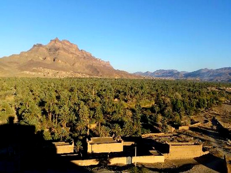
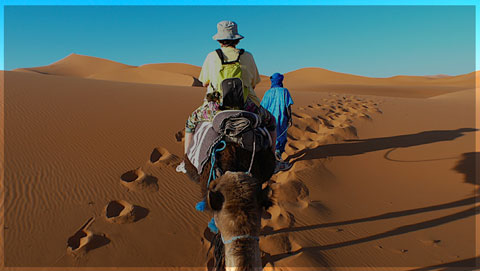
ZAGORA Les merveilles de la vallée du Drâa : 260 km de palmeraie. (Géoparc Jbel Bani)
ZAGORA Les merveilles de la vallée du Drâa : 260 km de palmeraie. (Géoparc Jbel Bani) Zagora n'est pas seulement un Stop-off-point pour des espaces verts le désert, mais aussi un panorama aux diff&eacut
Savoir plus...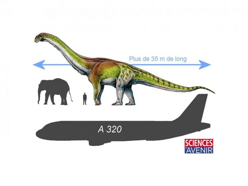
Le dinosaure le plus gros du monde était aussi long et lourd qu'un Airbus A320
Le dinosaure le plus gros du monde était aussi long et lourd qu'un Airbus A320 Ce dinosaure herbivore argentin pesait entre 65 et 77 tonnes et mesurait plus de 36 mètres de long. Représentation à
Savoir plus...
Tata / Tissint : Une oasis paradisiaque qui vaut le détour !
Tata / Tissint : Une oasis paradisiaque qui vaut le détour ! Outre la beauté des paysages de ses oasis, le village de Tissint, province de Tata, est aussi célèbre pour ses magnifiques cascades d’eau
Savoir plus...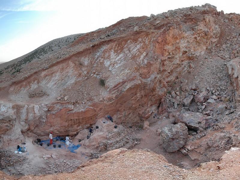
LE SITE DU JBEL IRHOUD
LE SITE DU JBEL IRHOUD LE SITE DU JBEL IRHOUD Ce site est désormais connu mondialement en raison de l’importance des découvertes archéologiques qui y ont été faites. Celles-ci début&egr
Savoir plus...Les tags en relation
En savoir plus sur " Géologie et TSGJB - AMDGJB ! "
Consulter les vidéos de " Géologie et TSGJB - AMDGJB ! " Consulter les photos de " Géologie et TSGJB - AMDGJB ! " Consulter les publications de " Géologie et TSGJB - AMDGJB ! " Consulter les éditions de " Géologie et TSGJB - AMDGJB ! " Consulter les communications de " Géologie et TSGJB - AMDGJB ! "Recherche du site
Recherche avancée / SpécifiqueVulgarisation à la géologie
Qu'est ce que les sciences de la terre: vulgarisation Qu'est ce que la géologie ? Géologie et TSGJB - AMDGJB !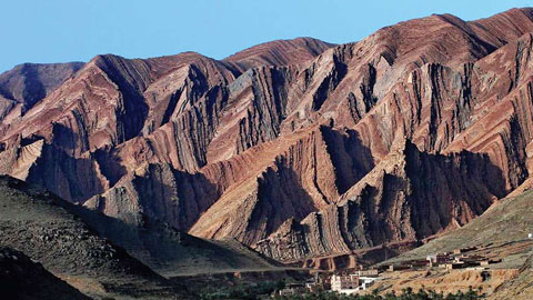
Géoparc et Recherche Scientifique
Le coins de l’étudiant
Blog Géoparc Jbel Bani
Dictionnaire scientifique
Plus de 123.000 mots scientifiques
Les publications
Géo parc Jbel Bani
Circuits & excursions touristiques
cartothéques
Photothéques
Publications & éditions