
A short overview of the Anti-Atlas, Morocco
DR.Hervé Rezeau, DR.Cyril Chelle-Michou & DR.Michael Calder
SEG Student Chapter of Geneva (Switzerland)
SEG Student Chapter of Montpellier (France)
INTRODUCTION
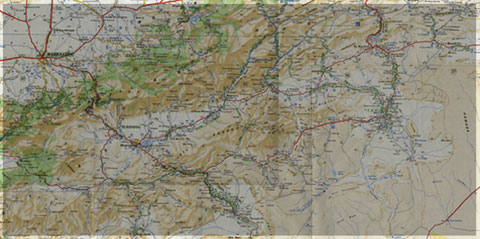
Geology of Morocco has been subdivided into four structural domains, from north to south they are the following: the Rif domain, the Meseta domain, the High Atlas, and the Anti-Atlas, as they are shown in (Figure 1).
The Rif Range extends along the Mediterranean coast from the Kabylian-Tellian belts up to the Strait of Gibraltar. South of it, the Meseta domain is located, where elevated plateaus and intramontane basins occur. Further south the High Atlas system is found, which displays several massifs close to 4000 m, including the highest peak of northern Africa (Jebel Toubkal). The Middle Atlas represents a branch of the Atlas system that extends obliquely across the Meseta domain, and exceeds 3000 m in elevation. Finally, the Anti-Atlas domain is found, which rises forming a massive mountain that achieves up to 2700 m. Further south the elevation decreases both southward and westward from ca. 1000 m to less than 200 m close to the Atlantic.

Figure 1: Elevation map of Morocco and neighbouring countries from GTOPO30 database (A. Michard et al. 2008)
GEOLOGICAL SETTING OF THE ANTI-ATLAS
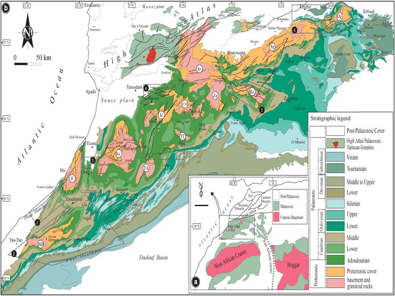
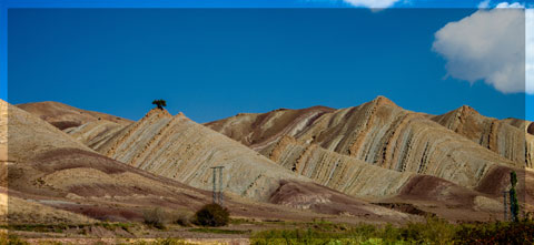
The Anti-Atlas mountain belt is located in the northern part of the West African Craton (WAC). It is stretching NE-SW and is characterized by Precambrian to late Proterozoic rocks covered by younger sediments of Edicaran to Cambrian in age. The geological boundary between the Anti-Atlas and High Atlas is structurally marked by the South Atlas fault (SAF) (Fig.2). The Anti-Atlas massif is a zone of wide domal uplift with much weaker Alpine age deformation. The volcanics and conglomerates rocks from the Ouarzazate & Bou Salda group in the North-East are surrounding the older volcanics rocks
The Anti-Atlas mountain belt is located in the northern part of the West African Craton (WAC). It is stretching NE-SW and is characterized by Precambrian to late Proterozoic rocks covered by younger sediments of Edicaran to Cambrian in age. The geological boundary between the Anti-Atlas and High Atlas is structurally marked by the South Atlas fault (SAF) (Fig.2). The Anti-Atlas massif is a zone of wide domal uplift with much weaker Alpine age deformation. The volcanics and conglomerates rocks from the Ouarzazate & Bou Salda group in the North-East are surrounding the older volcanics rocks and turbidite sequences from the Sahgro Group and the Pan-African granite intrusions. This geomorphological feature is commonly called inliers (“boutonnière” in French) and is the result of an exposed older rock formation surrounded by younger rock, and is due to a high erosion rate of rocks with different hardness but also encouraged by deformation such as folding and faulting (Gasquet et al. 2005). Several slivers of ophiolites are present in the Anti-Atlas belt, the best preserved are situated in the Bou Azzer, Siroua and Iriri region, which represent remnant of an ocean closure. The basement is composed of schists, granites and mylonites of Paleoproterozoic age. The latest Variscan and Alpine orogenic events overprint most of the Anti-Atlas geological province and thus complicate the Pre- Cambrian geodynamic interpretation. However, two main periods of tectono-thermal magmatic activity (Gasquet et al. 2005) are now recognised :
(i)A Palaeoproterozoic period, corresponding to the Eburnean (Birimian) orogeny,
(ii)A Neoproterozoic period, corresponding to the Pan-African orogeny.

Figure 2: Schematic map of the Anti-Atlas Precambrian inliers (Boutonnière), and location of the maps, satellite views and lithospheric profile presented hereafter (Gasquet et al. 2008)
Source web : DR.Hervé Rezeau, DR.Cyril Chelle-Michou & DR.Michael Calder unige.ch
Les articles en relation

Prise de décision relative au changement climatique: Quel rôle joue vraiment la météo ?
Prise de décision relative au changement climatique: Quel rôle joue vraiment la météo ? La prise de décision relative au changement climatique est fortement liée aux données mét&
Savoir plus...
Circuit 5 jours de Guelmim vers Agadir-géoparc jbel bani
Circuit 5 jours de Guelmim vers Agadir-géoparc jbel bani Çircuit de 5 jours : Circuito en 5 dias - Circuit in 5 days Jour 1 - Guelmim - Amtoudi - Akka - Tata Jour 2 - Tissint - Akka Naït Sidi Jour
Savoir plus...
La diversité génétique: un défi à relever pour une Conservation réussie des antilopes
La diversité génétique: un défi à relever pour une Conservation réussie des antilopes Au Jardin Zoologique National, une nouvelle conférence sur la thématique de la Conservation
Savoir plus...
Les rhinocéros du Maroc (espèce éteinte)
Jadis, à une époque antique où la moitié sud de notre pays ressemblait plus à une savane qu’à un désert , vivaient encore des espèces aujourd’hui éteintes, qu&rs
Savoir plus...
Surpâturage : Les Soussis et les nomades face à un ennemi commun (Géoparc Jbel Bani)
Surpâturage : Les Soussis et les nomades face à un ennemi commun (Géoparc Jbel Bani) Depuis le début du confinement sanitaire, la Toile est secouée par des vidéos montrant des agressions contr
Savoir plus...
Hyperloop Transportation Technologies dévoile sa capsule de transport de passagers
Hyperloop Transportation Technologies dévoile sa capsule de transport de passagers Longue de 32 mètres, la capsule Hyperloop Quintero One d'Hyperloop TT a été assemblée en Espagne et sera finali
Savoir plus...
La station spatiale chinoise se dévoile grandeur nature
La station spatiale chinoise se dévoile grandeur nature La Chine, qui prévoit de débuter la construction de sa station spatiale au début de la décennie 2020, en a présenté sa maquette
Savoir plus...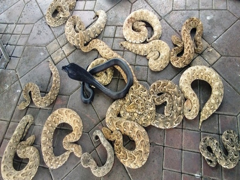
La vipère heurtante: une attaque parmi les plus rapides au monde
La vipère heurtante: une attaque parmi les plus rapides au monde La vipère heurtante (Bitis arietans) fait partie des serpents qui ont l’attaque la plus rapide au monde (2,6m/s). Elle vit au Maroc, et avec le cob
Savoir plus...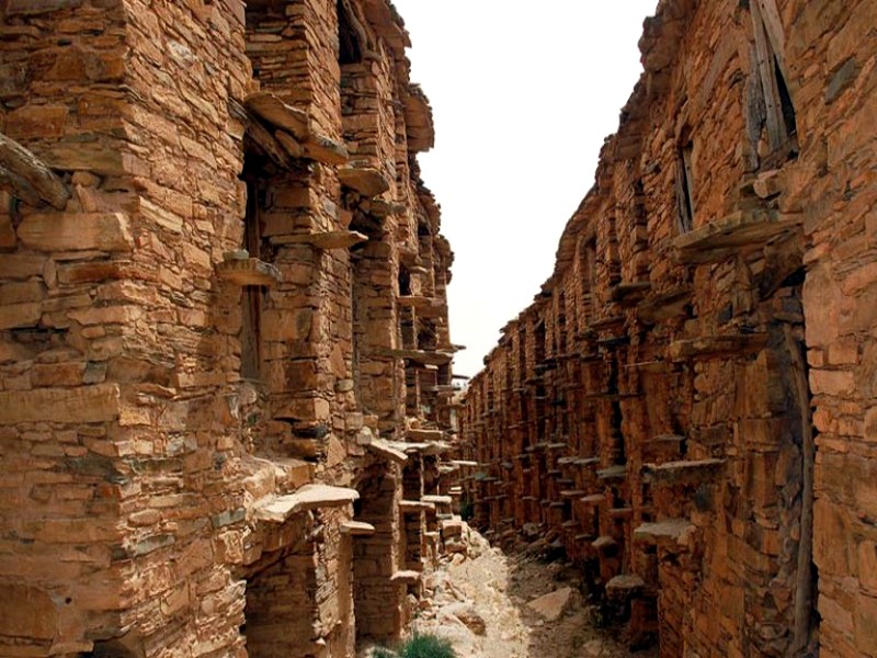
Restauration des Igoudars : le grenier d'Immchguiguen renaît dans l'Anti-Atlas
Restauration des Igoudars : le grenier d'Immchguiguen renaît dans l'Anti-Atlas La région de Souss-Massa poursuit ses efforts pour préserver et valoriser son patrimoine culturel unique. Dans l’arri&eg
Savoir plus...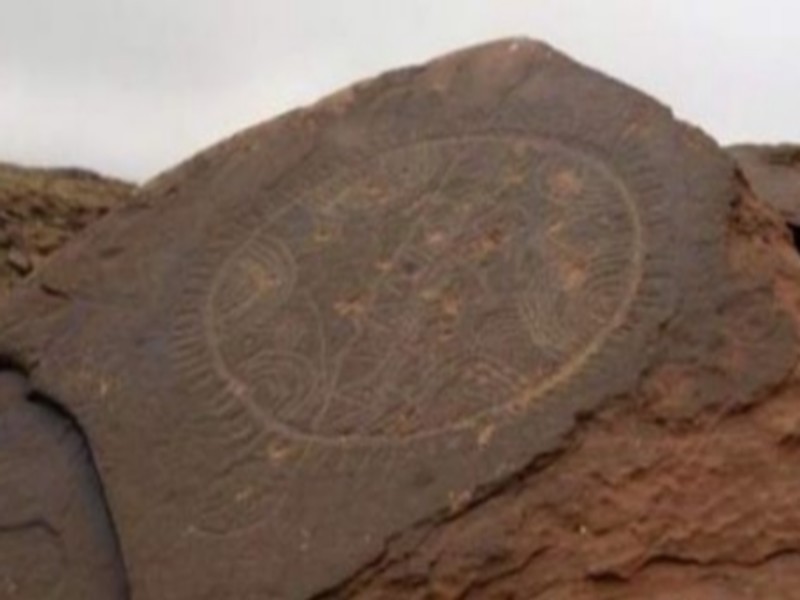
Archéologie: alerte au pillage du patrimoine marocain
Archéologie: alerte au pillage du patrimoine marocain Kiosque360. Un rapport international alerte sur le pillage du patrimoine archéologique du Maroc, bradé à des contrebandiers qui le revendent à d
Savoir plus...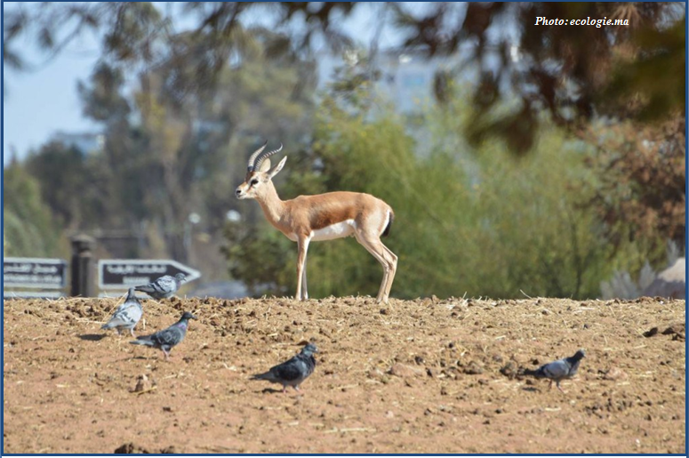
Errachidia: Introduction de 100 gazelles dorcas
Errachidia: Introduction de 100 gazelles dorcas (Source : ecologie.ma) Ce 10 Janvier, Le Haut Commissariat aux Eaux et Forêts et à la Lutte Contre la Désertification (HCEDLCD) a r&
Savoir plus...Les tags en relation
En savoir plus sur " Géologie et TSGJB - AMDGJB "
Consulter les vidéos de " Géologie et TSGJB - AMDGJB " Consulter les photos de " Géologie et TSGJB - AMDGJB " Consulter les publications de " Géologie et TSGJB - AMDGJB " Consulter les éditions de " Géologie et TSGJB - AMDGJB " Consulter les communications de " Géologie et TSGJB - AMDGJB "Recherche du site
Recherche avancée / Spécifique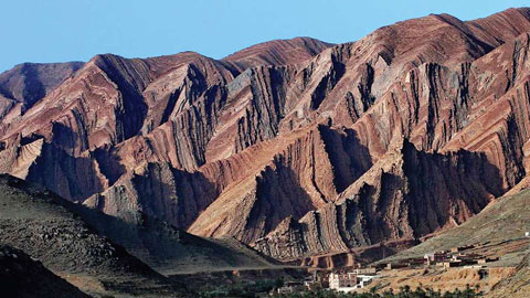
Géoparc et Recherche Scientifique
Le coins de l’étudiant

Blog Géoparc Jbel Bani
Dictionnaire scientifique
Plus de 123.000 mots scientifiques
Les publications
Géo parc Jbel Bani

Circuits & excursions touristiques
cartothéques
Photothéques
Publications & éditions