
CENTRAL ANTI-ATLAS TRAVERSE: the northern border of the West African Craton
By DR. M. OUKASSOU, DR. H. EL HADI, DR. F. HAISSEN, DR. N. SABER
ITINERARY and OBJECTIVES
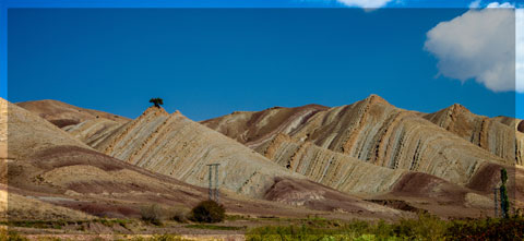
The south of Morocco is one of the most attractive touristic areas with diversified landscapes from snowy mountains to desert plains. The High Atlas with his 3000 to 4000 meters forms a major climatic barrier to the Atlantic perturbations, which account for the arid climate of the Anti Atlas sub Saharan domain south of the chain. These regions are occupied by berbere speaking populations with long hospitality tradition.
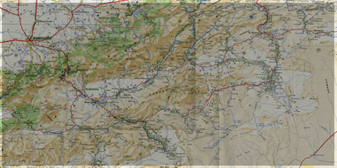
The two day trips follow most touristic roads and visit outstanding outcrops illustrating a central transect across the Anti-Atlas belt (figures G1 & G2), which corresponds to the external fold belt of the Hercynian (Variscan, Alleghanian) chain, but it also includes large Pan African inliers. The High Atlas formed during the Cenozoic at the expense of an aborted Triassic Jurassic rift. Therefore, three superimposed Wilsonian cycles can be illustrated during the trips. The itinerary will make possible to illustrate the complex geological history of these areas from 2 Ga to present day. Our purpose is to present and discuss various regional and thematic (sediment logical, structural, magmatic and
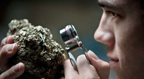
metamorphic) features, which record the main geodynamical events during this long geological history. Magnificent minerals (erhytrite, vanadinite...) and fossils (trilobites, goniatites...) can be purchased at many places.
During this field trip, the AgdzBou Azzer Tazenakht Agdzloop (figureG3)allows the participants to discover the PanAfrican belt (external platform domain in the Zenaga inlier, ophiolitic suture zone at Bou Azzer), the early volcano clastic cover sequence (late Neoproterozoic), and the mildly folded Early Paleozoic sediments (Cambrian and Ordovician).
Detailed road log for the trip are provided below along with Global Positioning Satellite (GPS) location at each stop. Note that all the stops are on public roads, and that the use of hammers and the collection of rocks are permitted.


Source web: DR. M. OUKASSOU, DR. H. EL HADI, DR. F. HAISSEN, DR. N. SABER sociedadgeologica.es
Les articles en relation
Des milliers d'empreintes de dinosaures découvertes dans le « Jurassic Park» australien
Sur la côte nord de l'Australie occidentale, un site, connu des aborigènes, recèle des milliers d'empreintes de pas de nombreuses espèces de dinosaures. Datée du Crétacé infé
Savoir plus...
Fin de printemps à Safia (Photo-reportage)
Fin de printemps à Safia (Photo-reportage) Pas loin de la frontière Maroco-Mauritanienne, Safia est une station d’acclimatation éloignée de 350 km sur la route de Nouhadibou du sud de Dakhla. Cette stati
Savoir plus...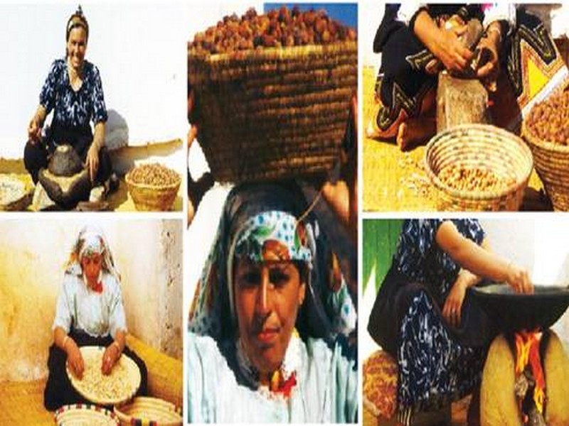
L’arbre sacré des régions du Sud: Les gardiennes de l’arganier
L’arbre sacré des régions du Sud: Les gardiennes de l’arganier L’Union des coopératives des femmes d’argane s’est distinguée à la COP22 en remportant le prix de l&rsquo
Savoir plus...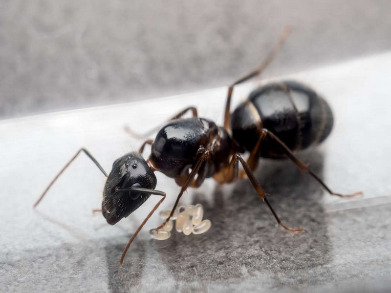
Top 5 des animaux zombies
Top 5 des animaux zombies Des animaux transformés en zombies le temps d'un film, au cinéma, d'accord, mais dans la réalité, est-ce possible ? La réponse est oui : la nature peut parfois nous
Savoir plus...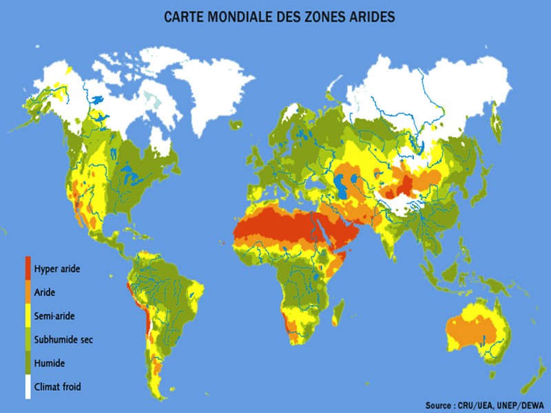
Les Eco systèmes des zones arides et semi arides
Les bioclimats du Maroc De par sa situation et composition géographiques, le Maroc présente des bioclimats ou zones climatiques très différentes. Tout d’abord, il est limité par une côte
Savoir plus...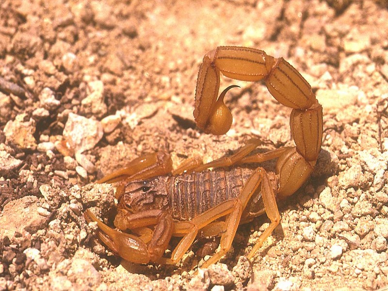
Les scorpions du Maroc (liste, photos et précautions)
« Les scorpions sont un ordre d’arthropodes de la classe des arachnides. Ils se distinguent des araignées par leurs pédipalpes en pinces et par l’aiguillon venimeux qu’ils
Savoir plus...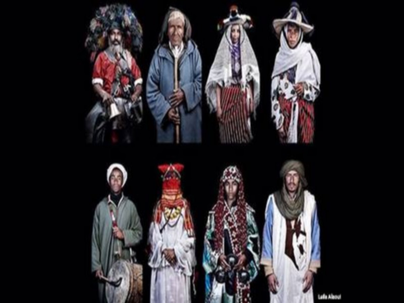
Etude : la taille des Marocains en stagnation depuis 1976
Etude : la taille des Marocains en stagnation depuis 1976 Une étude sur l’évolution de la taille des adultes durant le XXe siècle a vu le jour. Publiée lundi 25 juillet par la revue scientifique &laq
Savoir plus...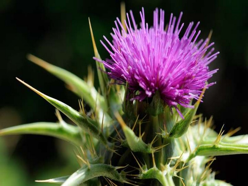
Chardon Marie
Chardon-Marie Le Chardon-Marie est une plante de la famille des Astéracées, de l'espèce Silybum marianum. La plante doit son nom à une légende : une goutte de lait de la Vierge Marie aurait lais
Savoir plus...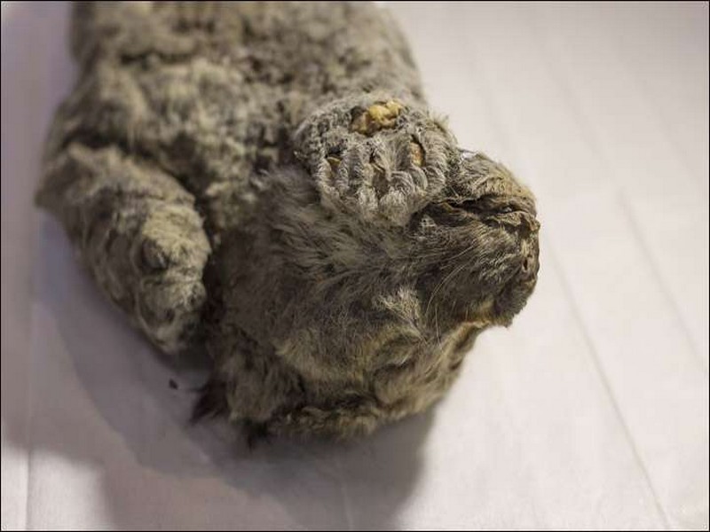
Un lionceau des cavernes retrouvé en Sibérie
Un lionceau des cavernes retrouvé en Sibérie Deux ans après la découverte de deux lionceaux des cavernes en Yakoutie, un nouveau spécimen de cette espèce disparue il y a plus de 10.000 ans a
Savoir plus...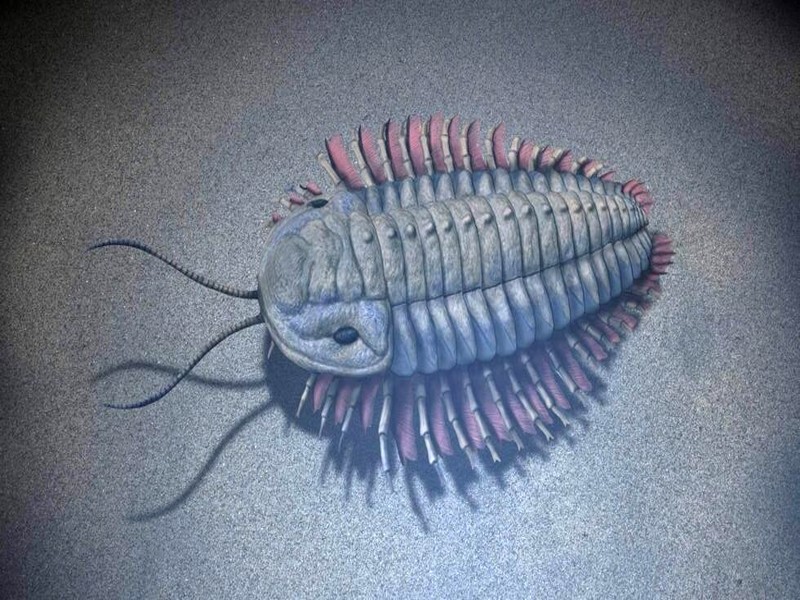
Découverte exceptionnelle au Maroc : Un écosystème de 515 millions d'années révélé sous la cendre volcanique
Découverte exceptionnelle au Maroc : Un écosystème de 515 millions d'années révélé sous la cendre volcanique Dans la région du Souss-Massa, à Aït Youb, au Maroc,
Savoir plus...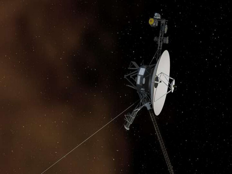
Voyager 2 serait proche de la frontière avec l'espace interstellaire
Voyager 2 serait proche de la frontière avec l'espace interstellaire Partie de la Terre, il y a déjà 41 ans, la sonde Voyager 2 pourrait bientôt entrer dans l'espace interstellaire. Il y a six ans,
Savoir plus...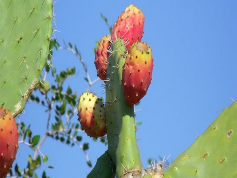
FAO: Pourquoi le cactus devrait être une "culture essentielle" au Maroc
FAO: Pourquoi le cactus devrait être une "culture essentielle" au Maroc Durant les périodes de sécheresse ou dans les zones arides, le cactus et la figue de Barbarie devraient constituer un atout pr&eacu
Savoir plus...Les tags en relation
En savoir plus sur " Géologie et TSGJB - AMDGJB ! "
Consulter les vidéos de " Géologie et TSGJB - AMDGJB ! " Consulter les photos de " Géologie et TSGJB - AMDGJB ! " Consulter les publications de " Géologie et TSGJB - AMDGJB ! " Consulter les éditions de " Géologie et TSGJB - AMDGJB ! " Consulter les communications de " Géologie et TSGJB - AMDGJB ! "Recherche du site
Recherche avancée / SpécifiqueVulgarisation à la géologie
Qu'est ce que les sciences de la terre: vulgarisation Qu'est ce que la géologie ? Géologie et TSGJB - AMDGJB !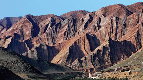
Géoparc et Recherche Scientifique
Le coins de l’étudiant
Blog Géoparc Jbel Bani
Dictionnaire scientifique
Plus de 123.000 mots scientifiques
Les publications
Géo parc Jbel Bani
Circuits & excursions touristiques
cartothéques
Photothéques
Publications & éditions