
CENTRAL ANTI-ATLAS TRAVERSE: the northern border of the West African Craton
By DR. M. OUKASSOU, DR. H. EL HADI, DR. F. HAISSEN, DR. N. SABER
ITINERARY and OBJECTIVES
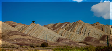
The south of Morocco is one of the most attractive touristic areas with diversified landscapes from snowy mountains to desert plains. The High Atlas with his 3000 to 4000 meters forms a major climatic barrier to the Atlantic perturbations, which account for the arid climate of the Anti Atlas sub Saharan domain south of the chain. These regions are occupied by berbere speaking populations with long hospitality tradition.
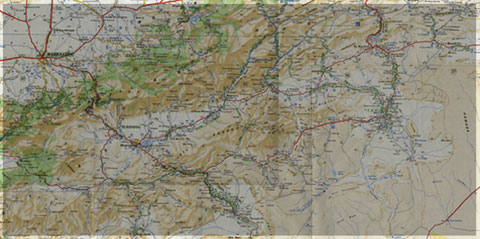
The two day trips follow most touristic roads and visit outstanding outcrops illustrating a central transect across the Anti-Atlas belt (figures G1 & G2), which corresponds to the external fold belt of the Hercynian (Variscan, Alleghanian) chain, but it also includes large Pan African inliers. The High Atlas formed during the Cenozoic at the expense of an aborted Triassic Jurassic rift. Therefore, three superimposed Wilsonian cycles can be illustrated during the trips. The itinerary will make possible to illustrate the complex geological history of these areas from 2 Ga to present day. Our purpose is to present and discuss various regional and thematic (sediment logical, structural, magmatic and
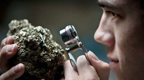
metamorphic) features, which record the main geodynamical events during this long geological history. Magnificent minerals (erhytrite, vanadinite...) and fossils (trilobites, goniatites...) can be purchased at many places.
During this field trip, the AgdzBou Azzer Tazenakht Agdzloop (figureG3)allows the participants to discover the PanAfrican belt (external platform domain in the Zenaga inlier, ophiolitic suture zone at Bou Azzer), the early volcano clastic cover sequence (late Neoproterozoic), and the mildly folded Early Paleozoic sediments (Cambrian and Ordovician).
Detailed road log for the trip are provided below along with Global Positioning Satellite (GPS) location at each stop. Note that all the stops are on public roads, and that the use of hammers and the collection of rocks are permitted.


Source web: DR. M. OUKASSOU, DR. H. EL HADI, DR. F. HAISSEN, DR. N. SABER sociedadgeologica.es
Les articles en relation
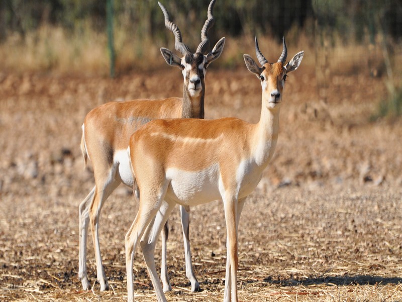
Les 5 antilopes du Maroc
Les Antilopes constituent un groupe de Mammifères Ruminants, rangés parmi les Bovidés. Les antilopes descendent de l’Eotragus, apparu au Miocène, il y a 15 à 17 millions d’an
Savoir plus...
INTRODUCTION
INTRODUCTION SUR LA PISTE DES BIJOUX DU MAROC DANIEL FAUCHON IBIS PRESS C’est lignes sont le raccourci d’une passion qui, pendant plus de dix année, tant la piste que sur le goudron, m’
Savoir plus...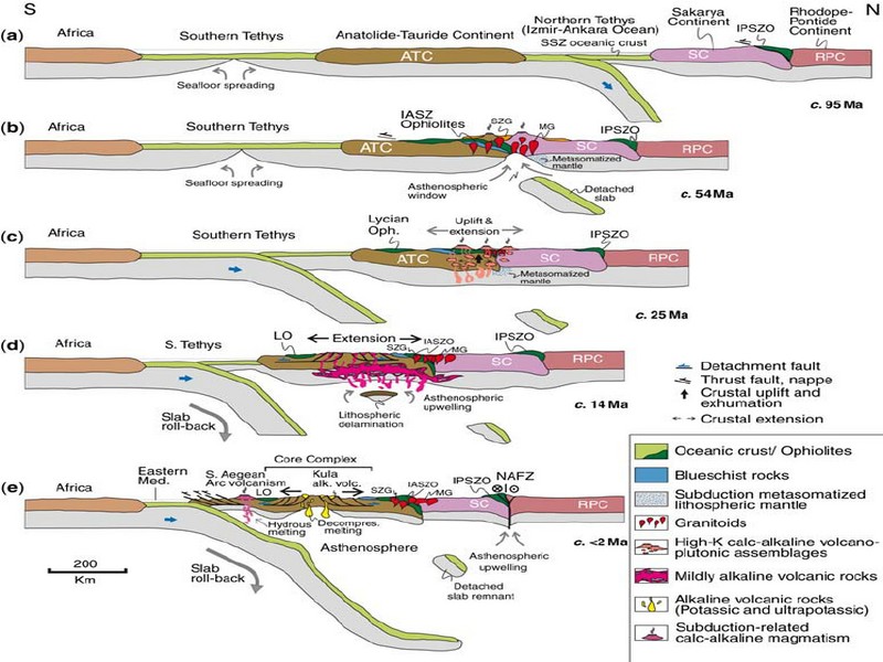
GEODYNAMIC EVOLUTION OF THE PAN-AFRICAN OROGENY
GEODYNAMIC EVOLUTION OF THE PAN-AFRICAN OROGENY Prof. Hervé Rezeau, Prof. Cyril Chelle-Michou & Prof. Michael Calder SEG Student Chapter of Geneva (Switzerlan
Savoir plus...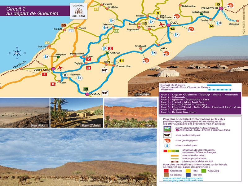
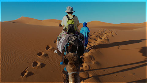
Circuit 8 jours au départ et retour vers Guelmim
Circuit 8 jours au départ et retour vers Guelmim Circuit de 8 jours Circuito en 8 dias - Circuit in 8 days Piste 4x4 Jour 1 - Départ Guelmim - Taghjijt - Ifrane - Amtoudi Jour 2 - Tafraoute Jour
Savoir plus...
Géoparc Jbel Bani Un Levier pour un Développement Durable, Inclusif, et Scientifiquement Valorisé
Géoparc Jbel Bani Un Levier pour un Développement Durable, Inclusif, et Scientifiquement Valorisé Au cœur du Sud Marocain, le Géoparc Jbel Bani émerge comme une initiative dynamiq
Savoir plus...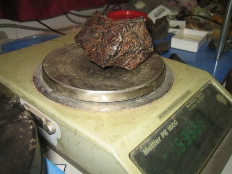
Laboratoire de géo-patrimoine et géo-matériaux de l’Université Ibn Zohr : Les premiers secrets de la météorite martienne «Tissint» révélés
Laboratoire de géo-patrimoine et géo-matériaux de l’Université Ibn Zohr : Les premiers secrets de la météorite martienne «Tissint» révélés Enfin la m&ea
Savoir plus...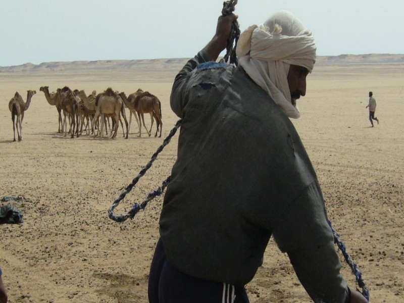
Sahel: trop de préjugés à l’encontre des éleveurs nomades
Sahel: trop de préjugés à l’encontre des éleveurs nomades C’est une première en Afrique. Une étude sur la perception de l’élevage nomade dans les médias a &eac
Savoir plus...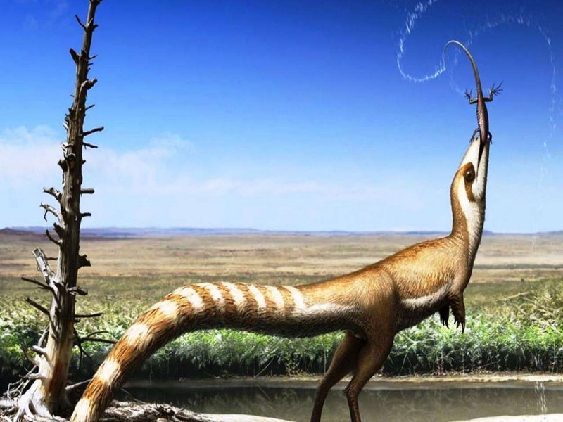
Les vraies couleurs du dinosaure Sinosauropteryx
Les vraies couleurs du dinosaure Sinosauropteryx Des paléontologues de l'université de Bristol confirment leur déduction d'il y a sept ans : les couleurs de Sinosauropteryx, le premier dinosaure à
Savoir plus...
Pourquoi l'ail donne-t-il mauvaise haleine ?
Pourquoi l'ail donne-t-il mauvaise haleine ? L'ail est souvent utilisé en cuisine mais son ingestion est inévitablement accompagnée d'une haleine indésirable. Tout comme pour les oignons, les s
Savoir plus...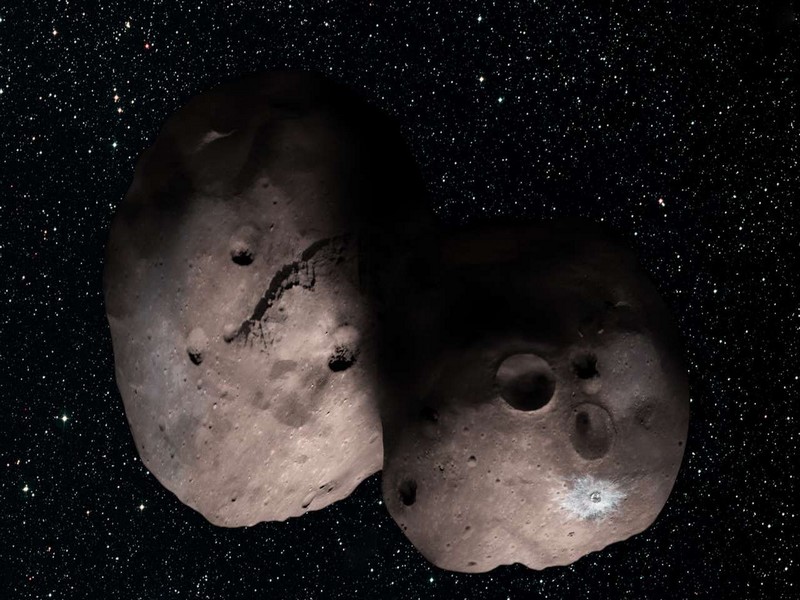
Aidez la Nasa à nommer cet étonnant astéroïde
Aidez la Nasa à nommer cet étonnant astéroïde Aux confins du Système solaire, à plus de 6,5 milliards de kilomètres de la Terre, l'énigmatique 2014 MU69 attend son surnom. La
Savoir plus...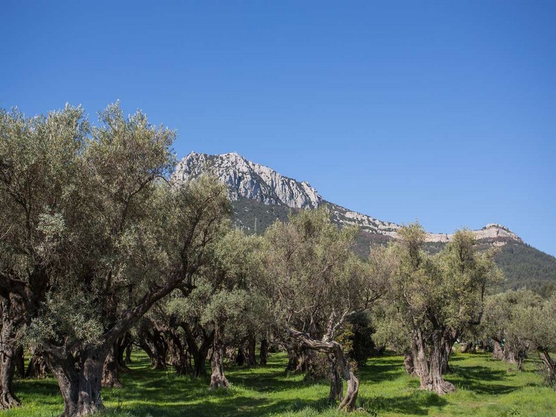
Climat méditerranéen
Climat méditerranéen Un climat se définit grâce à différentes données météorologiques. Les températures et les précipitations sont déterminantes en la
Savoir plus...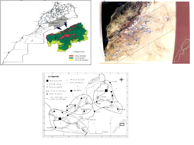
APPEL DU DESERT-géoparc Jbel bani
APPEL DU DESERT-géoparc Jbel bani Circuit de 3 a 4 jours Circuito en 3-4 dias - Circuit in 3-4 days Jour 1-TAN TAN - TILEMSEN - MSIED - piste AOUINAT TORKOZ - ASSA Jour 2 - ZAG - LABOURIAT - ASSA Jour 3-TARGOUMAIT-
Savoir plus...Les tags en relation
En savoir plus sur " Géologie et TSGJB - AMDGJB ! "
Consulter les vidéos de " Géologie et TSGJB - AMDGJB ! " Consulter les photos de " Géologie et TSGJB - AMDGJB ! " Consulter les publications de " Géologie et TSGJB - AMDGJB ! " Consulter les éditions de " Géologie et TSGJB - AMDGJB ! " Consulter les communications de " Géologie et TSGJB - AMDGJB ! "Recherche du site
Recherche avancée / SpécifiqueVulgarisation à la géologie
Qu'est ce que les sciences de la terre: vulgarisation Qu'est ce que la géologie ? Géologie et TSGJB - AMDGJB !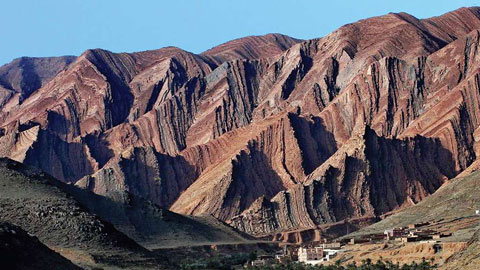
Géoparc et Recherche Scientifique
Le coins de l’étudiant
Blog Géoparc Jbel Bani
Dictionnaire scientifique
Plus de 123.000 mots scientifiques
Les publications
Géo parc Jbel Bani
Circuits & excursions touristiques
cartothéques
Photothéques
Publications & éditions